
Cnoc Leitreach [Owenduff] [Knockletragh]
Good walks are even better shared.
Overview
Cnoc Leitreach [Owenduff] [Knockletragh]
Cnoc Leitreach, standing at an elevation of 684 meters, presents a captivating feature of the Connemara region in County Galway. This Marilyn is a favourite amongst local hikers for its challenging yet accessible terrain and the rewarding views from the summit.
Geography and Geology
Nestled within a varied landscape, Cnoc Leitreach is primarily composed of granite and schist. The geological formations tell a story of ancient glacial movements that have shaped the awkwardly beautiful contours of this hill. A geological delight for enthusiasts, the area rich in biodiversity is also home to a myriad of flora and fauna.
Routes and Trails
The Cnoc Leitreach Loop is the most popular trail, starting at the Owenduff River trailhead. Covering a distance of approximately 8.5 km, this trail is well-marked and generally takes around 3.5 hours to trek, making it a moderate hike suitable for walkers with some experience. Along the way, you can enjoy the lush valleys, rugged terrain, and even catch the sound of the rushing river for a soothing auditory backdrop.
Summit Features and Views
At the summit, you will find a humble cairn, a perfect spot for resting and taking photographs to prove to your friends that you made it! The expansive views from the top are nothing short of breathtaking. On a clear day, you can spot the Twelve Bens and the gleaming Killary Fjord.
Hazards
Hikers should remain alert to rapidly changing weather conditions which can transform from sunny skies to fog in a matter of moments. The terrain can also be treacherous in places, especially when wet – think slipping rather than sliding.
Nearby Summits
If you fancy an adventure beyond Cnoc Leitreach, neighbouring peaks such as Mweelrea (814 meters) and Ben Gorm (686 meters) offer additional challenges and stunning scenery.
Access and Facilities
Getting there is reasonably easy – simply take a trip to Leenaun, where you can find some parking at a layby near the trailhead. Just don't expect to find a spot on a busy weekend! Leenaun offers a café where you can fuel up before your hike and a shop for any last-minute supplies.
A Journey through History
Etymologically, the name 'Cnoc Leitreach' rolls off the tongue and means 'Hill of the Ruin'. One can’t help but ponder the tales ingrained in its rugged facade. Local legends speak of giants and ancient hunters, hinting at a rich cultural significance surrounding this splendid hill.
Conclusion
Whether you’re a seasoned hiker or just fancy a gentle wander, Cnoc Leitreach offers a splendid outing with a touch of history, a sprinkle of fun, and a whole lot of natural beauty. Pack your boots, bring a friend, and prepare to be awed by this gem of Connemara.
Happy hiking!
Explore routes near Cnoc Leitreach [Owenduff] [Knockletragh]
Public walks starting within 80 km of this hill. Nearby does not mean a route reaches the summit; check its map and access before setting out.
No public routes are currently listed within 80 km of Cnoc Leitreach [Owenduff] [Knockletragh] on Walkmates. This does not mean there are no paths here. Explore the map and check local access information before planning a walk.
Route planning notes
These notes describe possible approaches, not verified navigable routes or permission to cross land. Check current paths, local access rules and conditions before setting out.
Cnoc Leitreach Loop
A scenic loop starting from the nearby Owenduff River trail, taking you through lush valleys and up to the summit.
Make a day of it, together
Find someone to share the walk with, or organise a day out along a route you like.
Hill facts and local notes
Classifications
Elevation
452m
1,483 ft
Prominence
305m
Coordinates
53.9392, -9.8552
F782004
OS Map
30
At the Summit
The summit features a modest cairn, providing a perfect photo opportunity, and offers some stunning panoramic views.
Terrain & Geology
Cnoc Leitreach is primarily composed of granite and schist, offering a fascinating glimpse into the area's geological history, shaped by ancient glacial activity.
Views & Scenery
From the summit, one can see the majestic Twelve Bens mountain range and the tranquil waters of Killary Fjord.
History & Heritage
Name Origin
Cnoc Leitreach translates to 'Hill of the Ruin', hinting at possible ancient structures or stories long forgotten.
Historical Significance
The mountain is a local landmark and is part of the folklore of the region, often mentioned in stories of the Connemara Giants.
Getting There & Facilities
Check current local access restrictions, parking rules and transport timetables before travelling. These notes do not confirm public access to the summit.
Parking
There is a small layby off the R344 at F782004, suitable for a few cars but fills up quickly on weekends.
Public Transport
Buses run from Galway to Leenaun; however, they are infrequent, so plan your travel accordingly.
Nearby Facilities
Leenaun offers some basic facilities including a small shop and a café serving great scones. Toilets can be found in the village.
Safety Information
Known Hazards
- Be cautious of changing weather conditions, especially fog and rain, which can reduce visibility quickly. Also, watch for slippery rocks and boggy patches.
General Safety Tips
- Check weather conditions before setting out
- Carry appropriate clothing and equipment
- Let someone know your planned route
- Take a map, compass, and GPS device
- Carry emergency supplies: food, water, first aid kit, torch
Hills
Some common questions about the hills answered
Are there group walks up Cnoc Leitreach [Owenduff] [Knockletragh]?
Many walkers use Walkmates to join or organise walks with others. You can check for group walks around Cnoc Leitreach [Owenduff] [Knockletragh] through the maps
Are there other walkers around Cnoc Leitreach [Owenduff] [Knockletragh]?
Activity varies by location and time, but Walkmates lets you see whether others have shared walks or shown interest in this area. Find other people through the walking friends search walking friends for Cnoc Leitreach [Owenduff] [Knockletragh] search or of course create your own walk for Cnoc Leitreach [Owenduff] [Knockletragh]
Can I organise a walk to Cnoc Leitreach [Owenduff] [Knockletragh]?
Yes. If there aren’t any walks listed already, you can create a walk and make it available for others to join.
If you're signed up to Walkmates, you can create a walk to Cnoc Leitreach [Owenduff] [Knockletragh].
How do I find a walk up this hill?
There are often multiple ways to walk this hill, depending on experience and route preference. Walkmates helps you explore walks and routes that others have shared.
Can I suggest a new route up Cnoc Leitreach [Owenduff] [Knockletragh]?
Yes. You can suggest or create routes to share with others. Walkmates focuses on the social side of walking, so routes are used to help people organise walks and explore areas together, rather than as detailed navigation tools or route libraries.
Other uses really appreciate knowledgeable walkers sharing their routes. Share your favourite route to Cnoc Leitreach [Owenduff] [Knockletragh] here
The is an error or something incorrect about this hill. How do I let you know?
We always strive to keep the information on Walkmates as accurate as possible. If you find an error, please let us know through the contact form and we'll aim to correct it as quickly as possible
Community Discussion
Comments
Location
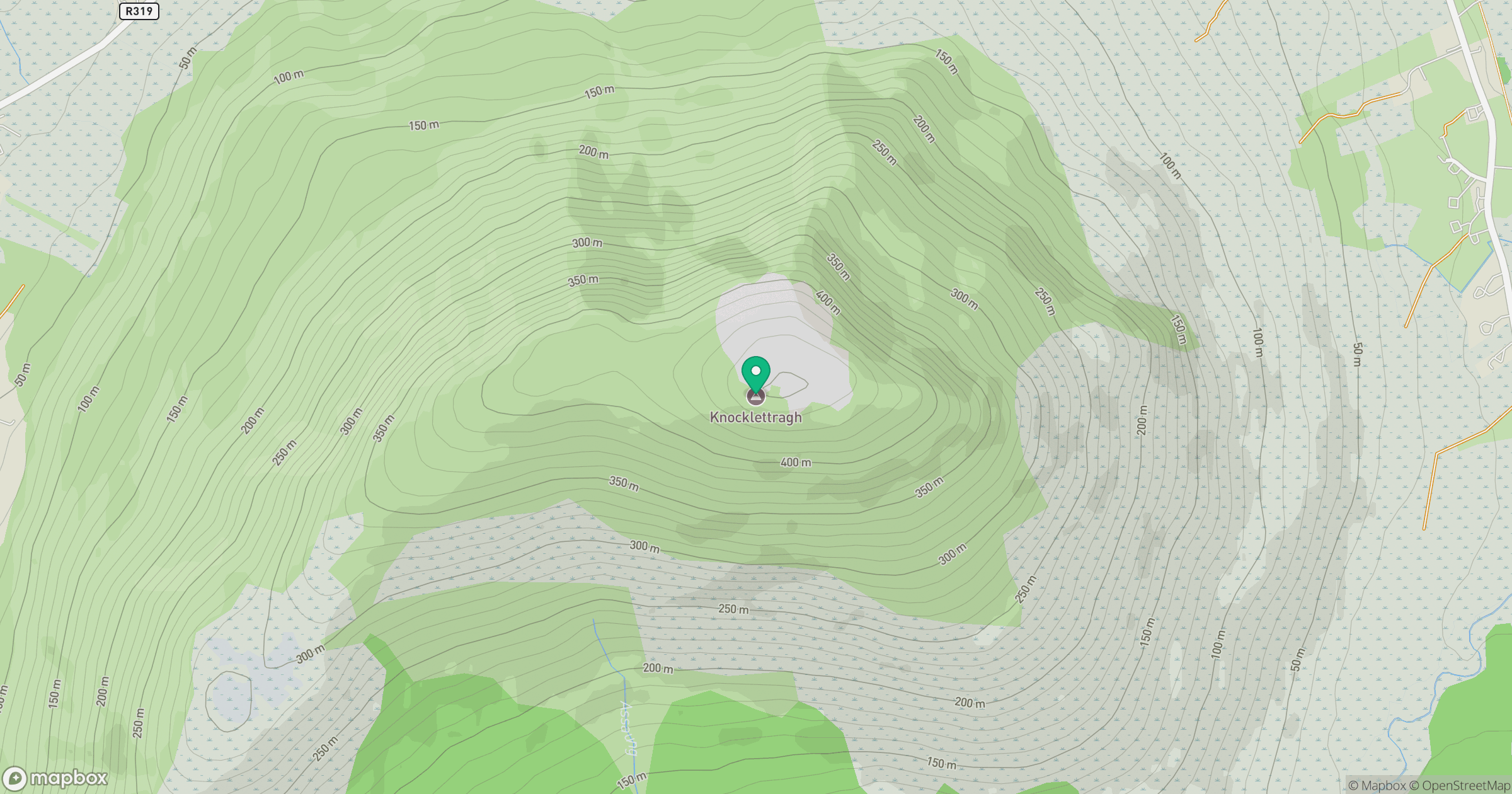
Grid reference: F782004
View on OpenStreetMapOpens a map in a new tab, centred on the hill.
Hills within 30 km
Straight-line distance, not a walking route or confirmation of access.
No comments yet. Be the first.